HEMA Map - Northern Territory State Map
HEMA Map - Northern Territory State Map is backordered and will ship as soon as it is back in stock.
Couldn't load pickup availability
Care information
Care information
Every order is carefully hand-packed and inspected to ensure it arrives safe, secure, and in perfect condition.
Delivery and Shipping
Delivery and Shipping
We ship Australia-wide using trusted carriers including Australia Post and Direct Freight Express.
Fast Dispatch: Orders are typically processed within 1–2 business days.
Tracking Included: All parcels come with tracking for peace of mind.
Reliable Service: We choose carriers based on speed, reliability, and coverage.
Delivery Options: Standard and express options available at checkout.
For more details or specific delivery questions, feel free to contact our team.
Description
Description
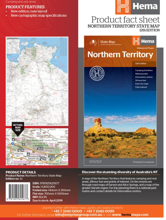
HEMA Map - Northern Territory State Map
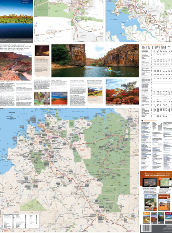
A map of the Northern Territory that has camping and rest areas, 24hour fuel and points of interest. On the reverse are through road maps of Darwin and Alice Springs, and a map of the greater Darwin region. For trip planning, there is a national park matrix and contact details for information centres.
Key Features
- GPS surveyed roads and tracks
- Fuel stops 4WD tracks
- Camping areas
- Historic sites
- Detailed inset maps
- Waterproof/Durable paper
Key Specifications
Edition: 12th
Publication Date: 28/10/19
Scale: 1:1,800,000
Folded size (WxHxD): 140mm X 250mm x 3mm
Flat size (WxH): 700mm X 1000mm
Weight: 0.09kgs
Payment & Security
Payment methods
Your payment information is processed securely. We do not store credit card details nor have access to your credit card information.


