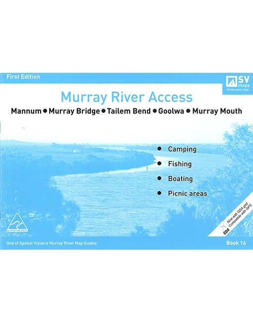
Murray Chart #16 Mannum Murray Mouth - Blue
Couldn't load pickup availability
Care information
Care information
Every order is carefully hand-packed and inspected to ensure it arrives safe, secure, and in perfect condition.
Delivery and Shipping
Delivery and Shipping
We ship Australia-wide using trusted carriers including Australia Post and Direct Freight Express.
Fast Dispatch: Orders are typically processed within 1–2 business days.
Tracking Included: All parcels come with tracking for peace of mind.
Reliable Service: We choose carriers based on speed, reliability, and coverage.
Delivery Options: Standard and express options available at checkout.
For more details or specific delivery questions, feel free to contact our team.
Description
Description
Murray Chart #16 Mannum Murray Mouth - Blue
Embark on a comprehensive river adventure with Murray Chart #16: Mannum Murray Mouth – an essential map in the renowned Murray River Access Maps series. Uncover premier camping, fishing, and boating spots along the iconic Murray River as this chart intricately covers the picturesque stretch from Mannum to the captivating regions of Murray Bridge, Tailem Bend, Milang, Lake Albert, Meningie, Lake Alexandrina, Goolwa, Coorong National Park, and the Murray Mouth.
Key Features:
-
Thorough River Exploration: Dive into the enchanting world of the Murray River with Murray Chart #16, meticulously detailing the region from Mannum to Murray Mouth. Whether you're an avid camper, a fishing enthusiast, or a boating aficionado, this chart is your indispensable tool for exploring the hidden gems along this iconic watercourse.
-
Premier Camping, Fishing, and Boating Locations: Unlock the treasures lining the Murray River, featuring pristine camping sites, top-notch fishing locations, and ideal spots for boating. Murray Chart #16 serves as your navigational guide, ensuring you craft unforgettable outdoor experiences amidst the stunning landscapes of Mannum, Murray Bridge, Tailem Bend, Milang, Lake Albert, Meningie, Lake Alexandrina, Goolwa, Coorong National Park, and the Murray Mouth.
-
Expert Mapping: This chart expertly covers the diverse region, providing a detailed overview of the river's bends, towns, and surrounding areas. Whether planning a day trip or an extended river exploration, Murray Chart #16 is your go-to resource for a seamless journey.
Why Choose Murray River Access Maps?
Murray River Access Maps stand out as the ultimate guide for river enthusiasts. Meticulously designed with accurate depictions of key landmarks, a user-friendly layout, and attention to detail, each chart is a valuable tool for navigating the Murray River. Whether you seek adventure, relaxation, or a bit of both, these maps enhance your experience along the Murray, making them an indispensable resource for every river explorer.
Embark on your Murray River adventure fully equipped with the knowledge and guidance offered by Murray Chart #16: Mannum Murray Mouth. Plan your next outdoor escapade and let the Murray River Access Maps be your trusted companion for a seamless, unforgettable experience along the Murray's enchanting waters.
Payment & Security
Payment methods
Your payment information is processed securely. We do not store credit card details nor have access to your credit card information.


